Center for Ocean Mapping & Innovative Technologies’
Webinar Series
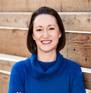
Ms. Jennifer Jencks
Ms. Jencks presents from 12-1pm Eastern on August 24th. To join via Teams, please click here.
Encouraging Innovative Supplementary Data Gathering: The International Hydrographic Organization Crowdsourced Bathymetry Initiative

Abstract: The International Hydrographic Organization (IHO) has long encouraged innovative supplementary data gathering and data maximizing initiatives to increase mankind’s knowledge of the depths of the seas, oceans and coastal waters. A recent effort, the IHO Crowdsourced Bathymetry (CSB) Initiative, is intended to encourage the collection and contribution of depth measurements from vessels, using standard navigation instruments, while engaged in routine maritime operations. While CSB data may not meet accuracy requirements for charting, it can be used to identify uncharted features, assist in verifying charted information, and fill gaps where bathymetric data are scarce. Using existing equipment, most ships are capable of measuring and digitally recording depth in coastal waters, while an increasing number of vessels can collect these data in deeper waters.
NOAA’s National Centers for Environmental Information (NCEI) hosts the IHO Data Center for Digital Bathymetry (IHO DCDB) and NCEI scientists collaborate as members of the IHO Crowdsourced Bathymetry Working Group. NCEI staff are working to enhance the DCDB infrastructure to provide improved archiving, discovery, and retrieval of global CSB and have recently stood up a scalable point data store in a cloud environment. The working group is currently developing strategies to encourage various maritime sectors (e.g.: cruise lines industry, regional fishing communities), either already equipped with appropriate technology or outfitted with inexpensive data loggers, to collect bathymetric data as part of normal operations. The vision is to tap into the enthusiasm for mapping the ocean floor by enabling trusted mariners to easily contribute data to fill the gaps in our current bathymetric coverage.
Biography: Jennifer Jencks is a Physical Scientist at NOAA’s National Centers for Environmental Information in Boulder, Colorado. For the last several years, she has served as the Director of the co-located IHO Data Center for Digital Bathymetry and chair of the IHO Crowdsourced Bathymetry Working Group. Much of her focus is on the data management aspect of ongoing national and international seafloor mapping initiatives. Before joining NCEI, Jennifer worked offshore for the Integrated Ocean Drilling Program and for a geophysical consulting firm in California. She earned her B.S. in Geological Engineering from the University of Mississippi and M.S. in Ocean Engineering from the University of Rhode Island.
