Center for Ocean Mapping & Innovative Technologies’
Webinar Series
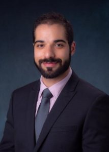
dr. Morteza Karimzadeh
Dr. Karimzadeh’s webinar is at 12pm Eastern on November 9th. Join via Teams (no registration required).
Locate the Floe: Challenges in High-resolution Mapping of Sea Ice using Machine Learning

Abstract: Sea Ice is an important component of the climate system, and an indicator of climate change. The Arctic region is warming up two to three times faster than the rest of the planet, resulting in significant changes in albedo as summertime ice vanishes faster, and increased summer-time ship traffic with increased likelihood of hazards. Monitoring and forecasting the state of sea ice is of high interest to both scientific and operational communities. Due to the combined effects of ocean currents, temperature, and winds, sea ice is highly dynamic, making its real-time tracking challenging. Expert ice analysts at a handful of National Ice Centers around the world generate ice-charts, i.e., snapshot maps of sea ice to be used for safe marine navigation in polar regions and the Great Lakes. With the ever-increasing availability of high-resolution Synthetic Aperture Radar (SAR) imagery, which acquire images independent of sunlight or cloud cover, there is renewed interest to automate mapping of sea ice. Our team, along with several others around the globe, has been creating foundational components for machine learning-based mapping pipelines of sea ice. In this talk, I will present how we tackle two major challenges in leveraging SAR Imagery for training sea ice mapping algorithms in the Arctic, namely reducing systematic noise in SAR imagery, and training on mixed samples derived from ice charts. I point to gaps and identify future directions for both the research and operational communities towards achieving real-time and high-resolution maps of sea ice. The framework presented here is sensor- and application-agnostic, and therefore, might be of interest to the broader remote sensing research and practice community.
Biography: Dr. Morteza Karimzadeh is an assistant professor of Geography and affiliate assistant professor of Computer Science at the University of Colorado (CU) Boulder. He joined CU from Purdue University, where he was a postdoctoral scientist at the School of Electrical and Computer Engineering. Morteza is a geospatial data scientist, with research cutting across machine learning, geovisualization, geographic information retrieval, and visual analytics. His primary research focuses on method development, spanning various domains including sea ice monitoring and forecasting, geo-text analytics, situational awareness, precision agriculture, and digital humanities. His research is use-inspired and human-centered, from visual design to ground truth creation, algorithm integration and evaluation, to domain deployment and field studies. His current research on using artificial intelligence for sea ice classification and mapping is funded by a National Science Foundation EarthCube award.
