Comit Happenings
Setting Sail into the World of Ocean Mapping and Hydrography
Aside from getting research experience in a different field, I also wanted to do something so out of my comfort zone and prove to myself that I am capable of such things. And when I say, “out of my comfort zone”, I mean it. This was my first research cruise ever in a topic I knew practically nothing about.
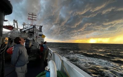
Charting off Charleston: Contributing to NOAA Marine Mapping on the U.S. Outer Continental Shelf
I had not been to Charleston in some 10 years and was struck by the street flooding caused by a mere high tide from a near-full moon the night of our arrival. Though we would be mapping offshore, seeing this underpinned the importance of mapping, especially in the coastal environment which has been increasingly impacted by events such as regular flooding due to sea level rise.
A look into the Hydrographic Community Aboard NOAA Ship Nancy Foster
I thoroughly enjoyed the science aspects of the cruise, but I equally enjoyed connecting with different members of the science party and the Nancy Foster crew. When I wasn’t working, you could find me playing a card game, working on a puzzle, or getting destroyed in backgammon.
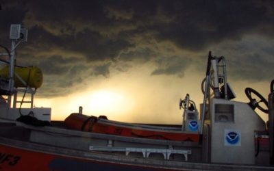
Seabed Mapping Research on the Blake Plateau
Seabed mapping is a lot more than just acquiring and processing bathymetric data. This was the first time a number of our students participated in a research cruise and there was a lot of new information to assimilate, including the work environment aboard a vessel.
Worlds Collide: Biology meets Hydrography
Everything about the software and protocols used to collect and process bathymetry is still completely new to me. Quite honestly, it felt like I was learning an entirely new language – which was actually quite enthralling!
Uncharted Waters: A Biologist’s Dive into Hydrography Aboard the NOAA Ship Nancy Foster
Life aboard Nancy was not without its challenges. Sleeping on a bunk bed like I was back at summer camp, setting my alarm for 3:30 AM to make it to the 4 AM shift on time, and adding Dramamine to my daily vitamins took some getting used to. Showering was a whole other ordeal. Imagine a game of pinball. Really imagine it. Now, imagine the machine is a shower, and you are the ball.
A Dive into the Tech Support Department
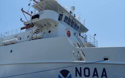
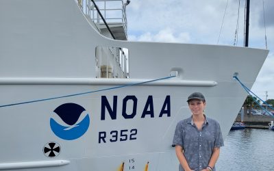
The Nancy Foster is one of the most operationally diverse ships in the NOAA fleet. Based out of Charleston, South Carolina, the crew aboard the Nancy Foster was kind enough to offer students from the University of South Florida, the College of Charleston, and the University of New Hampshire the opportunity to sail with them as they conducted mapping operations this summer.
GeoHab 2023, a reflection on my first international conference
I opened up the French doors to the patio, where I was hit with the perfume of plumeria blooming, and heard the strange calls of new birds. I saw lush greenery and volcanic peaks. I felt the presence of something familiar, an ocean. But there was also a distinct newness. I found myself in the Southern Hemisphere autumn, about 10,000 miles from Florida’s spring…
COMIT Student, Catalina Rubiano’s, Adventure and Exploration on the High-Seas aboard the Okeanos Explorer
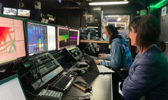
Above: COMIT student, Catalina Rubiano, in the mission control room aboard the Okeanos Explorer. Written by, Catalina Rubiano This summer as part of a NOAA Explorer-In-Training internship, I received the incredible opportunity to sail on the NOAA Ship Okeanos...