Center for Ocean Mapping & Innovative Technologies’
Webinar Series
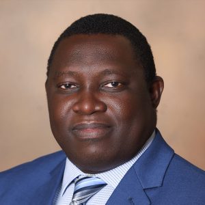
dr. Johnson Oguntuase
Dr. Oguntuase presented on March 23rd, to view a recording of his presentation, click here.
Spatially Advancing Ocean Mapping Using Emerging Technologies

Abstract: Many aspects of marine science benefit from accurate vertical positioning of two surfaces: the seabed and the sea surface. This webinar highlights the emerging positioning technologies and their prospects for ocean mapping and research projects. Notably, robotics and the automobile industry advancements drive the emergence of affordable mapping sensors and platforms that present new possibilities and research opportunities. In this webinar, the speaker will present previous and ongoing research projects related to accurate vertical positioning. (a) Low-cost positioning hardware (Global Navigation Satellite System {GNSS} receivers and antennas) for high accuracy positioning on ocean mapping platforms. (b) Antenna corrections effects when using uncalibrated low-cost antennas. (c) Preliminary results using a low-cost GNSS receiver for water level measurement at a remote location. (d) Surface and underwater vehicles in synergic operation for seafloor and water column mapping. The first research project was a collaboration with the Dr. Sunil Bisnath of York University, Canada, Dr. David Wells, and other faculty members at USM’s School of Ocean Science and Engineering (SOSE). The project focuses on the vertical accuracy of low-cost GNSS hardware as an alternative to high-end GNSS hardware in meeting shallow water mapping requirements. Previous studies rarely address the dynamic antenna scenario typical of hydrographic survey operations and the positioning performance that meets the aspirations of the hydrographic survey community. The research project concludes that low-cost GNSS hardware will provide < 10 cm vertical accuracy at a 95% confidence level, using the post-processed kinematic positioning strategy. The second research project is ongoing, and it is an offshoot of the first. It examines antenna phase-center corrections effects when using uncalibrated low-cost, circularly polarized antennas for high accuracy positioning. The third research project collaborates with Dr. Stephan Howden and other research scientists at SOSE. It highlights a preliminary result using low-cost GNSS hardware for water level measurement, leveraging the precise point positioning method on the sea. The fourth research project is also ongoing in collaboration with Dr. Anand Hiroji, Dr. Gero Nootz, and other SOSE faculty members. It aims at developing a new data acquisition strategy for measuring water column properties using multi-frequency SONAR aboard an uncrewed surface vehicle (USV) in synergetic operation with an autonomous underwater vehicle (AUV).
Biography: Johnson O. Oguntuase joined the University of Southern Mississippi in August 2021 as Assistant Professor of Hydrographic after a career as a professional land surveyor and business owner. He teaches applied acoustics, kinematic positioning, and applied bathymetry in the Masters of Science in Hydrography program. He also serves as the faculty-student liaison at the Division of Marine Science, USM. Dr. Oguntuase earned his Ph.D.degree in Marine Science with an emphasis in Hydrographic Science from the University of Southern Mississippi and afterward worked as a postdoctoral researcher using uncrewed systems for hydrographic mapping. He holds M.Sc. in Geoinformatics and Surveying (Geodesy specialization) from the University of Nigeria. Dr. Oguntuase’s research interests include the application of low-cost Global Navigation Satellite Systems (GNSS) and Inertia solutions for stringent positioning and bathymetric mapping requirements on uncrewed systems at sea.
