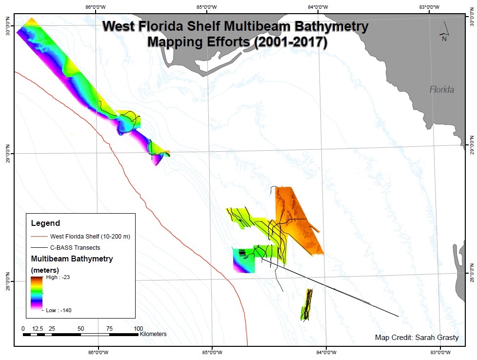
Though the West Florida Shelf is heavily utilized in terms of its abundant fisheries, much of it remains un-mapped and poorly characterized. Prior to 2015, high resolution bathymetry existed for only approximately 3% of this entire area. Under the Magnuson-Stevens Fishery Conservation and Endangered Species Acts there have been priorities set for management plans, namely the periodic or permanent closure of areas where spawning aggregations occur and/or where bycatch of organisms such as sea turtles is high. To better inform these decisions, more data and information about the West Florida Shelf are needed and this project has sought to fill some of the gaps.
Read more about the project here and meet our PI’s.

This National Fish and Wildlife Foundation (NFWF)-funded project began in April of 2015 and will continue through early-2020. During this time, we have conducted extensive multibeam bathymetry mapping and C-BASS (video mapping) operations each year. This has allowed us to almost double the amount of multibeam data available for the WFS and bring the total coverage closer to 6%. Our findings, reports, and publications are available on this site in the form of map downloads, videos, and an interactive GIS portal.

